
Many Readers will be familiar with the NCT. For those of you who are not it stands for North Country Trail and runs through both peninsulas of Michigan as well as New York, Pennsylvania, Ohio, Wisconsin, Minnesota, and North Dakota. It is still a work in progress, but there are many sections that are useable right now. The NCT has surprisingly a good website with an interactive map and is a great resource for planning trips along the trail. https://northcountrytrail.org/the-trail/trail-map-and-downloads/
This year they are hosting the 50 and 100 mile hiking challenge. Providing extra motivation for me to check out and hike new trails? You had me at “challenge”.
With previous hikes this year, I had 60 miles logged on the NCT. Faced with an extended weekend, I wanted to get in an additional 20 miles and see some sites along the way.
My trip started early on Saturday morning. I woke at 2:30 am and, after trying to go back to sleep for an hour, I decided to get moving. I was on the road at 4:15 am. Even on Labor Day weekend there is not much traffic on the roads at that time, so I made my way quickly to Hastings, Michigan.
I love small towns and will often go out of my way to meander my way home to visit them after a trip. That is how I originally found Hastings, on a slow drive home from Grand Rapids. Hastings is a ridiculously cute town and I got there in time for breakfast and to see the sun rise over Main Street.
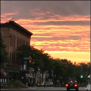
The Thornapple River flows through Hastings. They have an outdoor amphitheater next to it and a river walk.


Hastings is also 15 minutes away from Yankee Springs Recreation Area which was my first stop for some miles on the NCT.
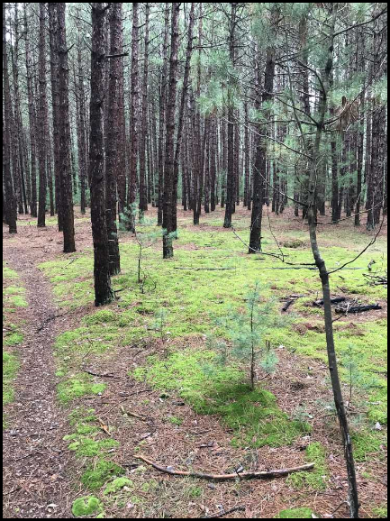
Yankee Springs is a large area with a large number of trails. Of course, the one I was interested in was the NCT. I was not (and am still not) familiar with Yankee Springs. I spent some time driving around looking for a suitable parking place. My NCT map had a couple of suggestions and I eventually found, just north of Chief Noonday Road

I wanted to get in 8 miles at Yankee Springs. When the Gaia App sounded of “4 miles”, I turned around and headed back.
This was moderate trail, mostly worn down to sand. It had a few hills to get my heart rate going. I was surprised to find no one on the trail. With it being Labor Day weekend and the campgrounds being filled, I expected to see more traffic on the trails. The only time I saw people was the short section where the NCT parallels the mountain bike path. I did run across this guy, but he was not very talkative.

At one point on the trail, I heard buuuUUZZZZ THAWACK BUUzzzzzz and something collided with my noggin. I initially thought that I had been stung as I heard buzzing and the struck area burned for a couple of minutes. However, the area never swelled up or become discolored. I now think I was hit by a falling acorn or nut. A half chewed nut had narrowly missed me earlier in the hike, perhaps there was a clan of ninja squirrels using me for target practice that morning.
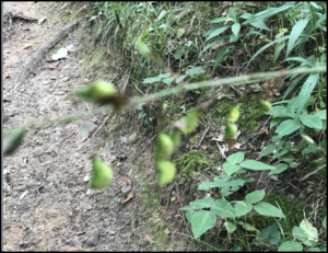
There were sections of the trail that were pretty thick with vegetation. In particular this thing (the blurry plant in the foreground) had very clingy seeds. I was covered in them from knees to ankles when I got back to my vehicle.
I got off the trail about lunch time and drove north to Middleville. Middleville consisted of only one block, but that block had some nice restaurants. I chose Champs and was happy with that choice.
Hmmm, those clouds look kind of threatening.

The Thornapple River goes through Middleville and so does the NCT. I wanted to get another four miles in here, bringing my total for the day 12. The NCT shares with other trails at many points, in Middleville it is also known as the Paul Henry Thornapple Trail. It felt a little bit like cheating here, as the trail here is a wide, paved bike path. The NCT symbol was clearly visible along the trail, so I am counting it.
At mile marker 1-1/2, the sky started getting very dark. At mile marker 1-3/4, it started to rain. I figured I was going to get soaked anyway, so I continued on to the 2 mile mark before turning around. It really opened up on me on the trip back and I got soaked.
I have friends in Grand Rapids and I went there for the night. The next morning, Tonia and I drove north to Croton for breakfast. Afterwards, we dropped of my truck and she drove me to an entrance to the trail at E. 58th Street. It was an 8 mile walk back to my truck.

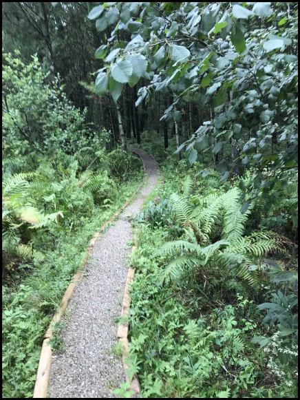
I really enjoyed this section of trail. It had a lot of changes to the scenary.
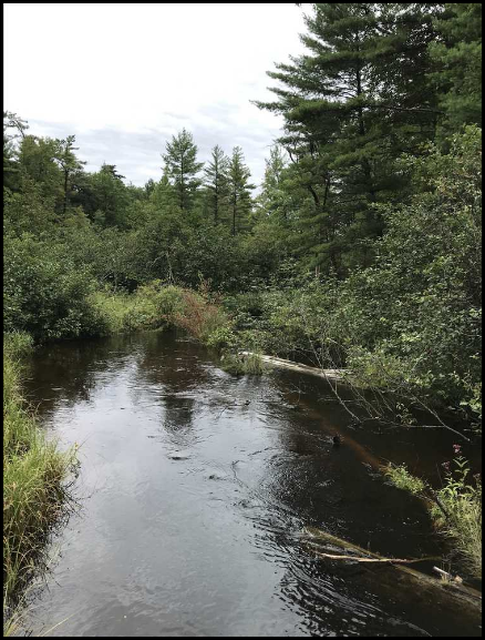
Some water (don’t worry, there is a bridge).


Yankee Springs is a large area. Since I was by myself, I did an out and back which meant I only saw 4 miles of the trail. I think there a lot of options in this park, especially if you use the multitude of other trails. I did not visit either of the camping areas (modern or rustic), both were booked for this weekend. Well, shoot, that isn’t a very conclusive conclusion. I guess this one is “deserves more research”.
The trail my Middleville was a wide, flat, paved trail; perfect for bicycles. I do not think I would got there for hiking again. I did enjoy my lunch at Champs: great food and great service. (Shout out to the folks at Champs).
The eight mile hike back to Croton was my favorite part of the trip. I enjoyed the changes from forest path to fields. Any of the large fields with their extended viewing area would make a great location to sit and enjoy a freezer bag of ramen eaten with a titanium fork. I would recommend this section.
Thanks for reading.